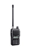
Detail GPS Magellan EXplorist 610
Descripsi - GPS Magellan eXplorist 610
GPS Magellan eXplorist 610 Kasar dan tahan air ( IPX-7) , GPS eXplorist 610 menggabungkan penerimaan GPS sensitivitas tinggi dengan mudah dibaca pemetaan dan navigasi yang akurat. Temukan jalan Anda menggunakan lebih dari 30 bidang data navigasi. Buat titik arah, trek rekor, dan rute dari titik ke titik. Kamera terintegrasi 3, 2 mega-pixel, mikrofon, dan speaker memungkinkan penggemar alam luar untuk merekam gambar geo-referenced dan catatan suara. Menghidupkan kembali petualangan outdoor Anda pada perangkat, pada komputer Anda, atau berbagi dengan orang lain di berbagai komunitas online seperti geocaching.com.
Nikmati geocaching paperless dengan eXplorist 610. Download dan melihat lebih dari 20 karakteristik unik dari masing-masing cache dan melihat, pencarian, filter pada perangkat. Rincian termasuk nama, lokasi, deskripsi, penyembunyi, ukuran, kesulitan, medan, petunjuk, dan log terakhir diciptakan oleh geocachers lainnya.
The eXplorist 610 bungkus peta paling akurat ke telapak tangan Anda. The World Edition peta memungkinkan untuk 2D atau 3D sudut pandang. Ini termasuk jaringan jalan lengkap di Amerika Serikat, Kanada, Eropa Barat, dan Australia dan jalan-jalan utama sepanjang sisa dunia dan memberikan orientasi kartografi di hampir setiap lokasi. , Peta preloaded unik ini juga mencakup fitur air, penggunaan lahan perkotaan dan pedesaan, dan latar belakang relief berbayang realistis. The eXplorist 610 juga mencakup Summit Series USA, peta topografi yang sangat rinci berdasarkan 1: 24, 000 peta sumber skala. Peta ini meliputi garis kontur, area penggunaan lahan, jalan, waterway7s dan tempat menarik. Cari trailhead terdekat. Cari toko-toko terdekat sepeda, stasiun bahan bakar, atau sumber air minum. Menavigasi aman di perspektif 3D sambil mengenal batas-batas antara lahan pribadi dan publik.
Yang terbaik dari kedua dunia, yang eXplorist 610 menggabungkan keramahan pengguna layar sentuh dengan keandalan dua tombol keras disesuaikan. Program tombol keras untuk dua fungsi favorit atau yang paling sering digunakan. Didukung oleh dua baterai AA, Explorist 610 akan bertahan hingga 16 jam dalam kondisi normal. Untuk membantu menghemat daya, gunakan mode penundaan untuk mematikan perangkat tapi mempertahankan pelacakan GPS. Anda juga dapat menyesuaikan pengaturan manajemen daya dengan preferensi Anda.
Penghargaan Magellan memenangkan menu favorit OneTouch ™ sekarang pada perangkat genggam kita. Ini menyediakan akses cepat ke bookmark tempat favorit. Mengatur rumah Anda, base camp, dan mobil. Mudah kembali menetapkan lokasi baru untuk setiap petualangan baru. 12 ikon disesuaikan untuk membuat pencarian pribadi, menyimpan lokasi unik, atau menetapkan akses cepat ke layar favorit Anda.
Feature GPS Magellan eXplorist 610 :
Core Outdoor Navigation Rugged and waterproof, the eXplorist combines high sensitivity GPS reception with aesthetic mapping and accurate navigation. Find your way using more than 30 navigational data fields. Create waypoints, record tracks, and route from point to point.
Experience Recording Integrated 3.2 mega-pixel camera, microphone, and speaker enables outdoor enthusiasts to record geo-referenced images and voice notes. Relive your outdoor adventures on the device, on your computer, or share with others on various online communities.
Superior Maps with 3D Perspective View The eXplorist series packs some of the most accurate maps into the palm of your hand. The World Edition map allows for 2D or 3D viewing angles and covers the globe with details roads and land use areas. Summit Series is a new breed of topographic outdoor maps covering various regions with high level of detail. City Series will add turn-by-turn routing to your handheld GPS receiver.
3.0" Touch Screen and Button Controls The best of both worlds, the eXplorist combines the user friendliness of a touch screen with the reliability of two customizable hard buttons. Program the hard buttons to your two favorite or most used functions.
3-axis Electronic Compass & Barometric Altimeter* Always know exactly where you are going, which direction is north, and your accurate altitude about sea level with built-in sensors. Know the direction to the geocache while standing still. Measure barometric pressure over time to track changing weather conditions. Use a number of different digital compass' to always understand your cardinal directions.
Paperless Geocaching Download and view more than 20 unique characteristics of each cache and view, search, filter on the device. Details include name, location, description, hider, size, difficulty, terrain, hint, and recent logs created by other geocachers.
16 Hours of Battery Life Powered by two AA batteries, the eXplorist 610 will last up to 16 hours under normal conditions. To help conserve power, use the suspend mode to turn off the device but maintain GPS tracking. You can also adjust power management settings to your preference.
OneTouch™ Menu Magellan' s award winning OneTouch™ favorites menu is now on our handheld devices. It provides instant access to bookmarks of favorite places. Set your home, base camp, and car. Easily re-assign a new location for each new adventure. 12 customizable icons to create personalized searches, save unique locations, or assign quick access to your favorite screens.
World Edition Pre-loaded Map The World Edition includes a complete road network in United States, Canada, Western Europe, and Australia and major roads throughout the rest of the world that provides cartographic orientation in almost any location. This unique preloaded map also includes water features, urban and rural land use, and a realistic shaded relief background.
Summit Series USA Summit Series USA is highly detailed topographic map based on 1: 24, 000 scale source maps. The map includes contour lines, land use areas, trails, waterways, and points of interest. Locate the nearest trailhead. Search nearest bike shops, fuel stations, or potable water source. Navigate safely in 3D perspective view while knowing the boundaries between private and public lands.
Navionics® Map Compatibility. Navionics is a world of products that enhance your enjoyment on and off your boat. Simply purchase a Navionics Gold Chart, HotMaps® Premium, or FishN' Chip Region ( sold separately) and plug the SD Card into the eXplorist 510, 610 or 710.
Tampilkan Lebih Banyak