Perusahaan ini terdaftar sebagai Free Member. Hindari melakukan pembayaran sebelum bertemu penjual atau melihat barang secara langsung. COD (Cash On Delivery) atau bertemu langsung dengan penjual merupakan metode transaksi aman yang kami sarankan.
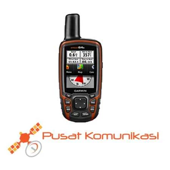
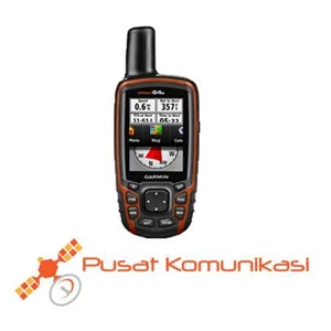
Garmin GPS Map 64S High Sensitivity satellite signal reception which ensures fast and accurate. Garmin GPS Map 64S has the specification: Physical form and use: Physical dimensions 2.4 " x 6.3" x 1.4 " ( 6.1 x 16.0 x 3.6 cm) Display size, WxH 1: 43 " x 2: 15" ( 3.6 x 5.5 cm) ; 2.6 " diag ( 6.6 cm) Display resolution, WxH 160 x 240 pixels Display type transflective, 65-K color TFT, transflective Weight 9.2 oz ( 260.1 g) with batteries Battery 2 AA batteries ( not included) ; NiMH or Lithium recommended Battery life 16 hours Water IPX7 rating Floats No. High-sensitivity receiver Yes Interface high-speed USB and NMEA 0183 compatible Maps & Memory: Yes basemap Preloaded maps no Ability to add maps Yes Built-in 4GB memory Data cards Accepts microSD ™ card ( not included) Waypoints / favorites / locations 5000 Routes 200 Track logs 10, 000 points, 200 saved tracks Features & Benefits: Automatic routing ( turn by turn routing on roads) Yes ( with optional mapping for detailed roads) Yes Electronic compass ( tilt-compensated, 3-axis) No touchscreen Yes Barometric altimeter Camera no Geocaching-friendly Isa ( Paperless) Custom maps compatible Yes Photo navigation ( navigate to geotagged photos) Yes Hunt / fish calendar Yes Sun and moon information Yes Tide tables Yes ( with optional BlueChart) Area calculation Yes Custom POIs ( ability to add additional points of interest) Yes Unit-to-unit transfer ( shares data wirelessly with Similar units) Yes Picture viewer Yes Garmin Connect ™ compatible ( online community where you analyze, categorize and share data) Yes additional Smart Notifications: yes Live Tracking: yes ( with Garmin Connect ™ Mobile)